
Verified Coverage in the Marion ZIP Code Directory
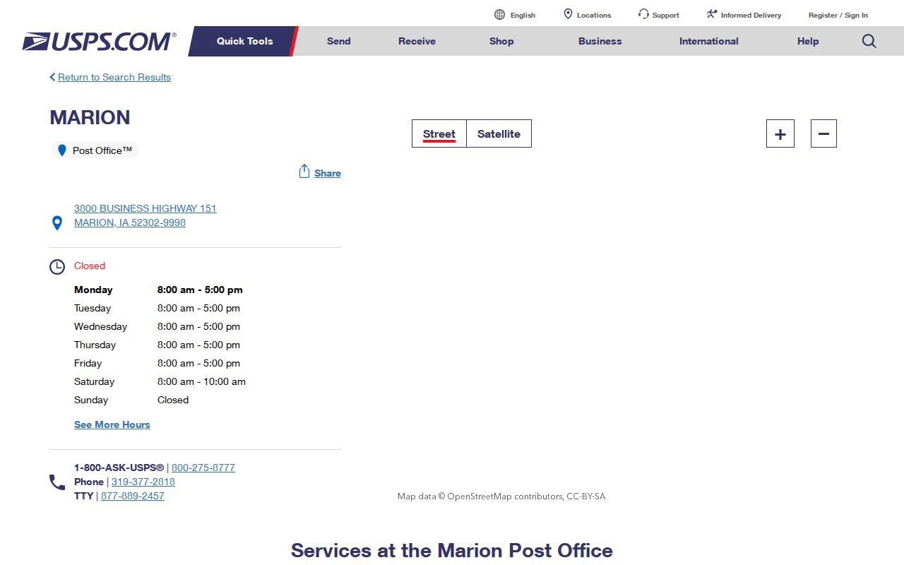
Official USPS research verified 52302 as the Marion Post Office ZIP. The other facilities below are nearby reference points, not proof that their ZIP codes serve addresses inside Marion. Use the USPS address lookup for a particular property.
| ZIP code | Area or facility verified | Post office | Directory note |
|---|---|---|---|
| 52302 | Marion postal location | 3800 Business Highway 151, Marion | Only ZIP confidently verified here as serving Marion |
| 52402 | Nearby Cedar Rapids geography | Northeast Station, 1380 60th Street NE | Not verified as serving Marion city |
| 52401 | Cedar Rapids | 615 6th Avenue SE | Nearby station only |
| 52404 | Cedar Rapids west | West Station, 1930 Wiley Boulevard SW | Nearby station only |
| 52233 | Hiawatha | 99 E. Willman Street | Not verified as serving Marion city |
The Marion Post Office phone is 319-377-2818. Published hours are Monday through Friday 8 a.m. to 5 p.m., Saturday 8 to 10 a.m., with all-day PO Box access. A station's proximity does not assign its ZIP to Marion.
The 2022 Marion ZIP Label Realignment
A 2022 USPS Postal Bulletin preserves 52302 with the destination label Marion while changing labels 52305 and 52314 formerly associated in the table with Marion 52302 to Mount Vernon 52314; 52336 also appears in the change table. This is a postal-label and route realignment, not proof that every listed ZIP lies inside Marion.
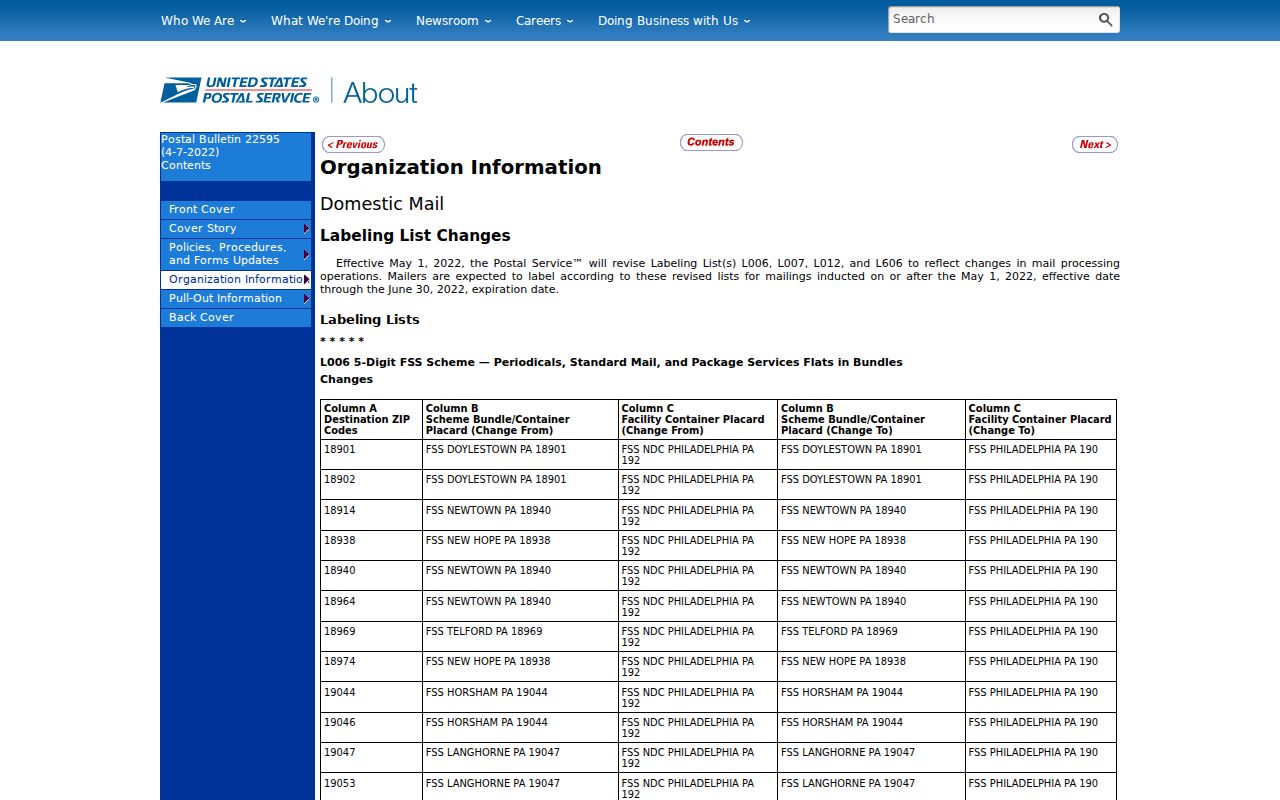
Do not turn a historical label into a boundary claim. Keep the address exactly as the dated source prints it, then verify today's mailing form separately.
Finding Marion Records by ZIP Code
The local portals accept address clues differently. Linn's assessor address form wants house number and street name and specifically omits city and ZIP. The Iowa voter confirmation tool requires first and last name, ZIP code, house number, and birth fields. Linn GIS exposes a SitusZip field that can support a ZIP-wide parcel query. Marion permit search uses service address, while AVA recorded instruments are keyed to parties and legal descriptions rather than a guaranteed ZIP search.
- Verify the complete mailing address through USPS rather than selecting a ZIP from a nearby station.
- For broad parcel geography, query the Linn GIS parcel layer for
SitusZip = '52302', then filterSitusCityto Marion and inspect the GPN and geometry. - Move from the parcel to assessor and recorder links to separate situs, owner mailing address, and legal description.
- For a specific registrant, use the Iowa voter lookup's required name, ZIP, house number, and birth inputs. Do not treat those matching inputs as a public ZIP roster.
- Once narrowed to a street number, follow the Marion by-street workflow for address-level evidence.
| Portal | ZIP-capable field | Other required clue | What the result means |
|---|---|---|---|
| Linn GIS parcel REST layer | SitusZip | Use SitusCity, GPN, or geometry to validate | Parcels labeled with that situs ZIP |
| Iowa voter lookup | Five-digit ZIP | Name, house number, birth month/day/year | Confirmation for the submitted identity |
| Linn assessor address form | No ZIP input | House number and street name | Matching assessment parcels |
| USPS address lookup | Returned ZIP and ZIP+4 | Complete deliverable address | Current postal format |
Situs, Mailing, and Legal Keys for Marion Parcels
Marion addressing has three simultaneous keys. The situs address is where a parcel physically sits and is used by assessor, GIS, and permit records. The mailing address is where an owner or contact receives notices and may be a PO Box or an address outside Iowa. The legal description and 15-character GPN identify land in deeds and parcel systems even when a street number is absent.
Linn GIS stores GPN, situs address, city, ZIP, legal description, parcel geometry, subdivision data, and assessor and recorder links. Lot, block, and subdivision descriptions can be mapped through plats; metes-and-bounds descriptions require the instrument or survey. For a disputed or new address, contact Linn County GIS and Marion Planning or Engineering. No separate published Marion E911 assignment database or complete address-change log was located.
Why Marion ZIP Code Boundaries Are Not City Limits
ZIP codes describe mail delivery. Marion's incorporated line, Census ZCTA, voting precinct, school zone, neighborhood, and parcel tax district are different layers. The official Linn ZIP map is useful countywide context, but it is not an address-level USPS guarantee. Census searches can display 52302, 52402, and 52403 statistical areas without proving that each delivers to addresses in the incorporated city.
- ZIP and ZIP+4
- A five-digit delivery area and a more precise four-digit add-on for a segment, building, or group of boxes.
- PO-box ZIP
- A code or delivery segment used for post-office boxes rather than evidence of a street location.
- Unique ZIP
- A code assigned to one high-volume organization. No unique Marion ZIP was verified.
- Carrier route
- A postal delivery sequence within a ZIP, not a neighborhood or city boundary.
For a boundary dispute, compare the city corporate-limit layer, parcel situs city, postal line, tax district, voter precinct, and legal description. Do not let a directory, nearby post office, or Census ZCTA decide municipal jurisdiction.
Marion Planning Areas Add Context, Not Postal Proof
City planning materials name Uptown Marion, Southeast Marion, Indian Creek, 29th Avenue, Hunters Ridge, Lowe Park, Northwest Growth Area, Boyson Trail, Thomas Park, South Conservation Area, Southeast Growth Area, and Northeast Growth Area. These labels help organize maps, plats, newspapers, and planning records, but they are not a complete legal neighborhood system and do not establish a ZIP code.
Annexation and development explain why an older directory may use township or settlement language rather than a modern Marion postal line. The research did not locate a complete official annexation, readdressing, or renaming chronology. Preserve the historical address as printed, bridge it with a plat or legal description, and verify the current address independently.
What ZIP Statistics Can and Cannot Say About Marion
Marion counted 41,535 people in the 2020 Census across 17.80 square miles of land, about 2,333 people per square mile. Census estimates were 42,542 for 2024 and 42,732 for 2025. These city figures size the local search context, but they are not a resident list and should not be assigned wholesale to ZIP 52302. A ZIP or ZCTA can extend beyond municipal lines, while the city population follows the incorporated boundary.
ZIP-wide does not mean person-wide. A GIS query returns parcels carrying a situs ZIP. It does not prove who occupies each parcel, where an owner receives mail, or who is registered to vote there.
For a dated address, preserve the postal line exactly as the source printed it. Then test the current full address through USPS and compare the Linn parcel's situs city, situs ZIP, tax district, and legal description. A change in postal label does not by itself show that a person moved. It may reflect route administration, annexation, new development, or the difference between a mailing address and the incorporated boundary. Historical directories, plats, deeds, city maps, and Census schedules can bridge the old form, but each must retain its own date.
If the GIS Hub or printable county ZIP map does not load, contact Linn County GIS with the address or GPN. Postal delivery questions belong to USPS, parcel assignment questions to GIS or the Assessor, and city-limit questions to Marion Planning or Engineering. Keeping those custodians separate prevents a ZIP code directory search from turning one map layer into a false resident or jurisdiction claim.